Hercules



OVERVIEW AND PROPERTY DESCRIPTION
The 100%-owned Hercules property is StrikePoint Gold’s flagship project and area of focus.
The Hercules Gold Project is situated within the Walker Lane trend in Lyon County, Nevada, USA, approximately 40 kilometres (km) to the southeast of Reno, Nevada, and 20 km to the east of the Comstock Gold Mine. The Property comprises 1,207 unpatented mining claims and 4 patented mining claims (“Hercules USA Claims”), 116 unpatented mining claims (“Minquest Claims”), and 51 unpatented mining claims (“Como Claims”) totalling 1,374 unpatented mining claims and 4 patented mining claims that cover approximately 10,368 hectares (ha).
General Location of the Hercules Gold Project

On August 30th, 2024, StrikePoint acquired the Hercules Gold Project by way of an acquisition agreement of all of the issued and outstanding common shares of Alcmene Mining Inc. in consideration for a cash payment of CAD$250,000 plus CAD$62,011 in legal, regulatory, and transaction fees associated with closing the transaction. Pursuant to the terms of the acquisition, StrikePoint also assumed estimated reclamation costs of CAD$22,749 related to the Property at the time of acquisition.
The Property consists of 116 claims under option from Minquest with an annual advance royalty payment of USD$50,000 per year to be paid between the years 2027 and 2032. The Minquest Claims and a 1-mile area of influence are subject to a 3% net smelter return (NSR) royalty payable to Great Basin Resources Inc. The Company may purchase 50% of the NSR royalty for USD$2 million at any point prior to 90 days post commercial production. Several small, isolated claim blocks have minor NSRs with associated buy downs.
Hercules Gold Mineral Claims

On February 17th, 2026, Hercules Gold USA LLC, a wholly owned subsidiary of Alcmene Mining Inc., entered into a Purchase and Sale Agreement with Fronteer Development (USA) LLC, a wholly owned subsidiary of Newmont Mining Corporation (“Newmont”), to acquire the Como Claims. This agreement is based on the following payments:
- USD$25,000 due on signing (the “Closing Cash Purchase Price”; paid).
- USD$50,000 due 12 months after the execution of the agreement.
- USD$75,000 due 24 months after the execution of the agreement.
- USD$150,000 due 36 months after the execution of the agreement.
- USD$1.5 million due within 120 days of completion of a Preliminary Economic Assessment on a Qualifying Deposit (250,000-ounce gold equivalent (AuEq) deposit) contained within the Como Claims.
- USD$35 million due within 120 days of commercial production from the Como Claims.
The Como Claims are subject to a 1.5% NSR royalty payable to Fronteer Development (USA) LLC, subject to a buydown to 1.0% for USD$1 million and a Right of First Refusal on the remainder.
To access the Property from U.S. Highway 50 via the Dayton Valley Road, continue east-northeast from Dayton for approximately 8 km. At the end of the pavement, a gate is located at the corner of Sections 9, 10, 15, and 16. The northwest corner of the Property is approximately 3.5 km west of the gate, along a gravel road. Generally, the Property can be accessed year-round. The Property has no significant climatic issues and thus work can be completed throughout the year.
The information that follows includes exerts from the Company’s most recent NI 43-101 Technical Report on Hercules entitled “NI 43-101 Technical Report on the Hercules Gold Project, Lyon County, Nevada, USA” dated June 30, 2026 (with an effective date of June 2, 2026) (the “Hercules Technical Report”). The report was prepared by Michael B. Dufresne, M.Sc., P. Geol., P. Geo. and Fallon T. Clarke, B.Sc., P. Geo. (together, the “Authors”) of Apex Geoscience Ltd., who are independent of StrikePoint Gold.
GEOLOGY AND MINERALIZATION
The Hercules Gold Project is located within the Great Basin of the Basin and Range geomorphic province. It lies within the Walker Lane Belt, a northwest-trending structural zone characterized by right-lateral strike-slip faults. The region’s geology is marked by Tertiary volcanism and epithermal mineralization, hosting several gold districts. The Property is situated in the northeastern Como Mining District dominated by Tertiary volcanic and volcaniclastic rocks. The Pine Nut Range, where the Property is located, exhibits faulting and deformation events, including the east-dipping Miocene Bull Canyon Fault and regional Walker Lane Belt trans-tensional deformation that caused extension related to Basin and Range tectonics.
The Property is underlain by Miocene-age volcanic flows, agglomerates, pyroclastic deposits, and volcaniclastic sediments, along with intermediate intrusive dikes. Thin-bedded mudstone and tuffaceous material are interbedded within these volcanic units. Post-mineralization Miocene to Pliocene basalt and rhyodacite flows overlie these units, resting on a paleosurface marked by a bentonitic clay zone. The Property’s structural framework is defined by en-echelon faults, mainly trending northeast, which are locally mineralized. Hydrothermal alteration is widespread, with argillic and silicic alteration assemblages in structurally controlled zones.
The Como Mining District, including the Property area, has been the focus of gold and silver mineralization exploration since the late 1860s. Historical precious-metal extraction in the Como Mining District primarily targeted structurally controlled, quartz-filled fissure-vein systems. The veins and vein-cemented breccia matrices are mainly composed of quartz, with some sulphide minerals, adularia, and calcite. The sulphide content in mineralized material is generally low. Mineralized quartz veins are found in extensional structural zones, exhibiting three main orientations. Hydrothermal alteration within the Como Mining District includes silicic, sericitic, argillic, and propylitic alteration assemblages.
The Hercules Gold Project exhibits gold-silver mineralization typical of the Como Mining District. Multiple subparallel mineralized structures, such as veins and vein breccias with alteration halos, predominantly trend northeast. Northwest-striking faults crosscut and displace the northeast-trending zones, with hydrothermal alteration along these structures. Mineralization occurs within northeast-trending en-echelon faults. Pre- to syn-mineralization faulting increased host rock permeability, enabling hydrothermal fluids to migrate along fracture zones. Two northeast-trending structural zones facilitated the formation of a composite vein system. Post-mineralization deformation includes northwest-trending right-lateral oblique-slip faults, which offset the northeast-trending en-echelon vein system. At Hercules, the four main mineralized zones, including Cliffs, Hercules, Northeast, and Loaves, are characterized by:
- Strike lengths of approximately 1,100–1,200 m, widths of 250–350 m, and vertical extents up to 200 m.
- Lithological and spatial characteristics resembling those of the Como district, suggesting a shared mineralization event and similar structural and stratigraphic controls.
- Hosting both high-grade fissure veins and lower-grade, potentially bulk-mineable mineralization.
- Quartz veins and vein breccias within strongly silicified country rock, forming structurally complex mineralized zones with evidence of multiple hydrothermal episodes.
The most continuous alteration zones occur in the Cliffs and Hercules target areas, separated by approximately 450 m of post-mineralization intermediate volcanic cover. The northern target-area vein zones are interpreted as structural extensions of the southern mineralized zones, with Loaves likely extending from Cliffs and Northeast from Hercules.
HISTORICAL EXPLORATION
Historical exploration at the Como Mining District in Lyon County dates back to the late 1850s. Exploration was soon abandoned in the 1860s when the Comstock Lode Deposits (off-Property) were discovered in Gold Hill and Virginia City, Nevada. Approximately USD$500,000 in gold and silver was produced from the Como District since its discovery (Couch and Carpenter, 1943), although none of this production is attributed to the Hercules area.
Beginning in the late 1880s, the Hercules Mining Company developed underground workings and reportedly mined and shipped mineralized material from the Property. Further development occurred several decades later, possibly in the mid-1920s to late 1930s; however, no production records are available. A placer mining operation was attempted on the Property in the 1970s; however, this proved to be ineffective and uneconomic due to the fine grain size of the gold particles.
Historical exploration at Hercules has been conducted by several companies from the mid-1960s to 2022, including Rapidan Silver Mines (1968), St. Joe American (1977-1981), Amoco (1981), Meridian Gold (1982- 1983), Asamera Minerals (1983), St. Joe Gold Corp. (1984-1985), Horizon Gold Corp. (1986), Amax Exploration (1987-1900), Pioneer Mining Corp. (1992), Phelps Dodge Corp. (1993), AngloGold Ltd. (1999- 2000), Teck Resources (2000), Lincoln Gold Corp. (2004), Western Exploration (2002), Fjordland Exploration Inc. (2004-2012), American Goldfields Inc. (2005-2007), Willow Creek Enterprises (2010), Iconic Minerals Ltd. (2012), Eclipse Gold Mining Corp. (“Eclipse”; 2019-2020), and Elevation Gold Mining Corp (as Northern Vertex Mining Corp; 2021-2022). Historical exploration has consisted of geological mapping, geochemical sampling, geophysical surveying, drilling, and metallurgical testwork. A total of 27 diamond drillholes (DDH) and 369 reverse circulation (RC) drillholes, totalling 4,312.00 m and 41,922.95 m, respectively, have been completed at the Hercules Gold Project. Select historical drill results are presented below in Table 1.1.
| Hole ID | From (m) | To (m) | Length* (m) | Gold (g/t) | Silver (g/t) | Target |
|---|---|---|---|---|---|---|
| H834A | 29.26 | 33.53 | 4.27 | 1.37 | - | Hercules |
| HY0402 | 3.05 | 19.81 | 16.76 | 0.72 | 6.45 | |
| H20010 | 27.43 | 117.35 | 89.92 | 0.65 | 12.51 | |
| including | 51.82 | 82.30 | 30.48 | 1.10 | 26.17 | |
| H20031 | 0.00 | 30.48 | 30.48 | 1.63 | 18.27 | |
| including | 6.10 | 9.14 | 3.05 | 5.55 | 47.9 | |
| HY9502 | 112.78 | 118.87 | 6.09 | 2.33 | 9.54 | Cliffs |
| HY9509 | 74.68 | 82.3 | 7.62 | 2.85 | 5.58 | |
| HR1111 | 73.15 | 85.34 | 12.19 | 1.28 | 14.55 | |
| HR1211 | 70.1 | 76.2 | 6.1 | 1.46 | 13.4 | |
| H1204 | 59.44 | 71.63 | 12.19 | 0.73 | 6.82 | |
| and | 86.87 | 89.92 | 3.05 | 24.88 | 11.52 | |
| and | 97.54 | 100.59 | 3.05 | 11.68 | 23.45 | |
| H20040 | 184.40 | 224.03 | 39.62 | 1.12 | 5.38 | |
| including | 185.93 | 192.02 | 6.1 | 5.04 | 14.93 | |
| HY8919 | 28.96 | 48.83 | 19.87 | 1.17 | 8.02 | Northeast |
| H0605 | 38.1 | 45.72 | 7.62 | 0.71 | 6.89 | |
| H0725 | 20.48 | 32.67 | 12.19 | 0.66 | 4.41 | |
| H20002 | 1.52 | 47.24 | 45.72 | 0.33 | 1.87 | |
| HY8508 | 7.62 | 27.43 | 19.81 | 0.65 | 4.56 | Loaves |
| including | 21.34 | 27.43 | 6.09 | 0.84 | 6.52 | |
| HY8704 | 13.82 | 19.91 | 6.09 | 1.06 | 4.39 | |
| and | 44.2 | 47.24 | 3.04 | 3.48 | 4.03 | |
| H20003 | 71.63 | 85.34 | 13.72 | 0.40 | 6.01 | |
| NC-1 | 109.73 | 111.25 | 1.52 | 1.54 | - | Sirens (Black Rock) |
| NC-2 | 68.58 | 70.1 | 1.52 | 1.02 | - | |
| BR08-07 | 16.76 | 18.28 | 1.52 | 6.41 | - | |
| BR08-09 | 60.96 | 62.48 | 1.52 | 4.18 | - | |
| H20006 | 15.24 | 38.10 | 22.86 | 0.32 | 1.93 | Rattlesnake |
| CA-4 | 92.96 | 121.92 | 28.96 | 2.41 | 14.88 | Como (Elgin Vein) |
| including | 94.49 | 106.68 | 12.19 | 5.02 | 32.23 | |
| CA-5 | 161.54 | 182.88 | 21.34 | 1.82 | 4.66 | |
| including | 178.31 | 182.88 | 4.57 | 4.66 | ||
| CA-8 | 135.64 | 167.64 | 32.00 | 0.42 |
*All interval lengths are presented as downhole length. Grades of gold (Au) and silver (Ag) are reported as grams per tonne (g/t). Historically, true widths at the Hercules, Cliffs, Northeast, Loaves, and Rattlesnake targets were estimated at between 60% and 90% of the downhole length. True widths for the Sirens and Como targets are unknown.
Drilling in the Como Target area has been conducted predominantly by Amax Exploration and AngloGold Ltd. Amax Exploration completed a 46-hole RC drilling program totaling 5,386 m, which returned predominantly trace gold values along the Como and Rapidan veins.
AngloGold Ltd. subsequently completed a 17-hole RC drilling program targeting the Como and Elgin vein systems in the southern portion of the Property. Select downhole length intercepts from the AngloGold Ltd. program include drillhole CA-4, which returned 2.41 grams per tonne (g/t) Au over 28.96 m, including 5.02 g/t Au over 12.19 m; drillhole CA-5, which returned 1.82 g/t Au over 21.34 m, including 4.66 g/t Au over 4.57 m; and drillhole CA-8, which returned 0.42 g/t Au over 32.00 m, including 1.82 g/t Au over 3.05 m and 0.74 g/t Au over 9.14 m. All reported intercepts are from historical drilling along the Elgin vein system.
Geophysical surveys conducted at the Property include ground induced polarization (IP) and airborne electromagnetic (VTEM), magnetic, and radiometric surveys completed by Eclipse in 2020. The IP survey data indicated a correlation between silicification zones in outcrops and drilling with resistivity features and delineated two parallel and continuous north-northeast-trending steeply west-dipping structures which are named the Hercules Structural Zone, as well as a large resistivity feature in the southern portion of the survey area. The airborne geophysical survey highlighted an extensive, volcanic centre-related hydrothermal system at the Hercules Gold Project. Interpretation of the airborne geophysical survey data indicates that mineralization in the northern portion of the Property is potentially controlled by a structural intersection between curviplanar concentric structures and a deep-seated radial structure.
Historical exploration and drilling within the Property have delineated several mineralized target areas in the Property, including Hercules, Cliffs, Northeast, Loaves, Luck Rusty, Rattlesnake, Sirens, Sprite, Pony Meadows, Como, and Como-Comets. All the target areas, except Sprite, show multiple subparallel moderate to steeply east-dipping gold-silver (Au-Ag) mineralized structures, trending northeast. These include epithermal-style veins, vein breccias, and broad haloes of silicification outcrops on surface. The Sprite Target consists entirely of subcrop.
STRIKEPOINT EXPLORATION
As of the Effective Date of this Report, StrikePoint has completed 36 RC drillholes totalling 5,353.6 m at the Hercules Gold Project. Drilling at the Hercules Target intersected broad zones of near-surface gold-silver mineralization with locally higher-grade intervals. Mineralization has now been demonstrated over multiple drill campaigns and remains open laterally and at depth. Significant intercepts are listed as follows:
- H25001: 18.27 m downhole length at 0.61 g/t Au and 4.66 g/t Ag from 62.42 m depth, including 6.09 m downhole length at 1.33 g/t Au and 10.38 g/t Ag.
- H25004: 32.04 m downhole length at 0.54 g/t Au and 4.62 g/t Ag from surface, including 6.10 m downhole length at 1.50 g/t Au and 11.75 g/t Ag.
- H25006: 10.67 m downhole length at 1.17 g/t Au and 18.13 g/t Ag from surface, including 6.10 m downhole length at 1.90 g/t Au and 29.90 g/t Ag.
- H26001: 47.24 m downhole length grading 0.34 g/t Au and 3.10 g/t Ag from 103.63 m depth, including 12.19 m downhole length grading 0.51 g/t Au and 4.40 g/t Ag from 135.64 m depth.
- H26003: 25.91 m downhole length grading 0.37 g/t Au and 6.70 g/t Ag from 80.77 m depth, including 4.57 m grading 1.03 g/t Au and 14.8 g/t Ag from 80.77 m depth; plus 32.01 m downhole length grading 0.32 g/t Au and 3.60 g/t Ag from 149.35 m depth and 1.52 m downhole length grading 3.21 g/t Au from 193.55 m depth.
- H26011: 21.34 m downhole length grading 0.62 g/t Au and 8.6 g/t Ag, with the hole ending in mineralization, indicating the zone remains open at depth.
- H26018: 13.72 m grading 0.76 g/t Au and 1.66 g/t Ag from 7.62 m depth, including 1.52 m grading 5.94 g/t Au and 5.20 g/t Ag from 13.72 m depth.
The Cliffs Target hosts the broadest and most continuous mineralization identified on the Property to date. Drilling has expanded the mineralized footprint southward, and mineralization remains open to the south and at depth. Highlights from StrikePoint’s drilling at Cliffs include:
- H25005: 117.35 m downhole length grading 0.45 g/t Au and 3.55 g/t Ag from 187.45 m depth, including 12.19 m grading 2.17 g/t Au and 9.55 g/t Ag from 210.31 m depth.
- H26004: 114.3 m downhole length grading 0.69 g/t Au and 5.03 g/t Ag from 135.64 m depth, including: 9.14 m grading 2.95 g/t Au and 16.18 g/t Ag from 153.92 m depth; 7.62 m grading 1.02 g/t Au and 6.76 g/t Ag from 217.93 m depth; and 9.14 m grading 1.23 g/t Au and 6.62 g/t Ag from 230.12 m depth.
Drilling at the Loaves Target intersected multiple zones of shallow gold-silver mineralization, including locally higher-grade intervals such as 1.52 m downhole length grading 2.06 g/t Au and 5.70 g/t Ag from 36.58 m depth in H26010.
Initial drilling at the Lucky Rusty Target confirmed gold-silver mineralization at one of the northernmost showings on the Property. The occurrence of mineralization more than 2 km north of the Cliffs Target demonstrates the scale of the mineralized corridor and indicates potential for additional exploration along the trend.
The drill results in this section are presented as downhole lengths. Historically, true widths at the Hercules, Cliffs, Northeast, Loaves, and Rattlesnake targets were estimated at between 60% and 90% of the downhole length. True widths for the recent drilling, as well as at the Sirens and Como targets, remain unknown at this time.
Spring 2025 Drill Program
In March of 2025, StrikePoint Gold completed 7 drillholes totaling approximately 1,400 meters of reverse circulation drilling on the Hercules Gold Project. All seven holes hit near surface gold in significant quantities. Initial results were reported in the Company’s April 28, 2025 news release. Complete drill results from the Spring 2025 can be found in the company’s May 5 news release.
The results show broad zones of near surface gold mineralization at Hercules and are in line with the Exploration Target for the property (below). They delivered strong mineralization at the southern extremes of the target areas, indicating that the mineralizing systems remain robustly open.
Highlights include :
Hole 25004 cut 32.04 meters of 0.54 g/t Au and 4.62 g/t Ag starting at surface Including 4.57 meters of 1.14 g/t Au and 10.53 g/t Ag and 6.10m of 1.50 g/t Au and 11.75 g/t Ag
Hole H25005 which cut 117.35 m of 0.45 g/t Au with 3.55 g/t Ag is the furthest south drilling on the Cliffs target to date and shows that the system remains open to the south. The next nearest hole to the to H25005 is historic hole H20040 which returned 39.62m of 1.12 g/t Au with 5.38 g/t Ag.
These two holes give a strong indication of the strength of the mineralization at the southern portion of the Cliffs Target.
Hole H25007 was drilled to test a geochemical anomaly to the east of the Loaves showing and hit two zones of encouraging grades.

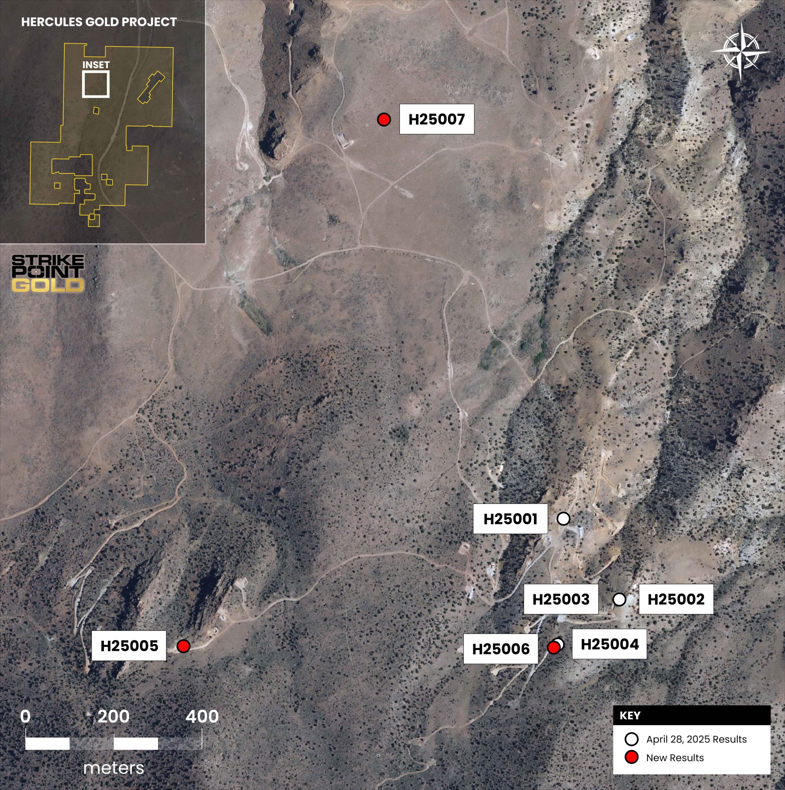
Similarly, H250006 encountered 10.67m of 1.17 g/t Au and 18.13 g/t Ag starting at surface with an additional 44.20m of 0.35 g/t Au and 4.34 g/t Ag showing that multiple zones of the Hercules showing are also open to the south.
Exploration Target
On March 3, 2025, StrikePoint announced the conclusion of its first technical report on the Hercules Gold Project including the establishment of a drill defined, bulk tonnage Exploration Target. This initial technical report is a significant step in providing valuable information on the project and as to the opportunity and potential size and scope of Hercules.
The Exploration Target used data from the Sirens, Hercules, Cliffs, Loaves, Lucky Rusty, Rattlesnakes, and Northeast showings at Hercules. In this area there are a total of 306 historical drillholes yielding a total of 31,776 meters in the drillhole database along with data for 121 surface trenches. The drillhole database contains a total of 18,409 sample interval entries, with the trenches providing another 475 sample entries. A total of 5,620 sample intervals are contained within the mineralization domains utilized for the Exploration Target.
In addition to the above showings, the Exploration Target does not include the additional 45 untested geophysical targets with similar signature to known mineralization on the 100 km2 land package.
NOTE: The quantity and grade are conceptual in nature, and there has not been sufficient exploration to define a mineral resource, and it is uncertain if further exploration will result in the target being delineated as a mineral resource. The Exploration Target Model has not been evaluated for reasonable prospects of eventual economic extraction. Further disclosure are found in the Company news release dated March 3, 2025
| Exploration Target | ||
| Tonnage Range (tonnes) | Grade Range (g/t) Au | |
| 39,800,000 – 68,700,000 | 0.46 – 0.61 | |
CONCEPTUAL EXPLORATION TARGET
A conceptual Exploration Target has been delineated at the Property and is disclosed herein. The potential quantity and grade, of the conceptual Gold Exploration Target for further exploration is expressed as ranges (Table 1.2). The 2026 Hercules conceptual Exploration Target (the “Exploration Target”) was completed by Mr. Dufresne, M.Sc., P.Geol., P.Geo. of APEX. Mr. Dufresne takes responsibility for the Exploration Target detailed herein.
The Exploration Target was developed using recent (2025) and historical drilling, surface trenching data, and gold assay results from the Hercules, Cliffs, Northeast, Loaves, Lucky Rusty, Rattlesnakes, and Sirens target areas. The Como area was not evaluated for a potential Exploration Target. Mineralization trends at Hercules were evaluated using global ordinary kriging with a large search (ranges of 200m, 100m, and 50m) and a maximum of 30 composites (maximum of 6 composites per drillhole) to generate a smoothly varying trend model in combination with current geological understanding. This approach was used to estimate the distribution of potentially mineralized tonnes and to support the generation of grade-tonnage curves. The upper and lower uncertainty ranges are based on applying Au cutoffs of 0.2 g/t and 0.3 g/t. The Exploration Target is conceptual in nature, and further exploration, including drilling, will be required to determine if a mineral resource can be delineated.
The conceptual Exploration Target for the Hercules Gold Project is presented in Table 1.2.
Table 1.2 Hercules Gold Project conceptual Gold Exploration Target*
| Exploration Target | ||
| Tonnage Range (tonnes) | Grade Range (g/t) Au | |
| 39,800,000 – 68,700,000 | 0.46 – 0.61 | |
Note*: The stated potential quantity and grade is conceptual in nature, and there has not been sufficient exploration to define a mineral resource, and it is uncertain if further exploration will result in the estimation of a mineral resource. The Exploration Target has not been evaluated for reasonable prospects of eventual economic extraction. The Exploration Target expressed should not be misrepresented or misconstrued as an estimate of a mineral resource or mineral reserve. Source: APEX (2026)
The stated potential quantity and grade is conceptual in nature, and there has not been sufficient exploration to define a mineral resource, and it is uncertain if further exploration will result in the estimation of a mineral resource. The Exploration Target has not been evaluated for reasonable prospects of eventual economic extraction. The Exploration Target expressed should not be misrepresented or misconstrued as an estimate of a mineral resource or mineral reserve.
CONCLUSIONS AND INTERPRETATIONS
Based upon a review of available data and information, historical and recent exploration data, Mr. Dufresne’s site inspection, and the conceptual Exploration Target, the Authors outline the Hercules Gold Project as a property of merit prospective for the discovery of additional gold mineralization. This conclusion is supported by knowledge of:
- The favourable geological setting of the Property and its position within the Walker Lane trend in Nevada.
- Historical surface exploration and drilling conducted by previous operators that intersected gold and silver mineralization and defined several targets within the Property.
- Gold and silver mineralization returned from the recent drilling programs conducted by StrikePoint and the calculation of the conceptual Exploration Target.
- Gold mineralization returned from prior surface rock sampling and confirmed with rock samples collected during Mr. Dufresne’s site inspection.
As a property of merit, a two-phase work program is recommended to delineate additional gold and silver mineralization at the Property, to evaluate the potential for delineating an Initial Mineral Resource Estimation for the Hercules Gold Project, and to test the newly acquired Como Target area and regional greenfield targets in the southern Property area.
As not all assay results from the 2026 drill program have been received as of the Effective Date of this Report, final drill targets for the Phase 1 exploration program should be delineated following the receipt and comprehensive analysis of the outstanding data. However, given the preliminary results from recent drilling, Phase 1 should include step-out drilling to the south of the Cliffs Target. The mineralization at Cliffs Target remains open to the south and at depth. The Author recommends a drilling program of approximately 1,750 m for Phase 1 at the Hercules Gold Project.
Furthermore, the Phase 1 exploration program for the Como Target area should prioritize the validation of historical datasets and the refinement of drill targets through systematic geochemical sampling and localized geological mapping across the newly acquired claims. This surface work should be designed to refine the controls of the Elgin vein and other high-grade targets. The estimated cost of the Phase 1 work program for the Hercules Gold Project totals USD$770,000, including contingency funds but exclusive of taxes.
Phase 2 exploration is strictly contingent on positive results from Phase 1. It should include additional geochemical sampling and drilling at the Hercules Gold Project to follow up on the Phase 1 results, as well as drill testing of geophysical and geochemical targets in the southern Property area, including the Sirens, Pony Meadows, Como-Comets, and Como target areas. The Author recommends using the Phase 1 drilling data to evaluate the potential for delineating an Initial Mineral Resource Estimate at the Property. However, there is no certainty that the Phase 1 exploration will result in the Exploration Target being successfully delineated as a Mineral Resource.
For additional information on the Authors’ recommended future program at Hercules, refer to the Hercules Technical Report.
Exploration Target
Table 1: Hercules Gold Project Exploration Target Model *
Exploration Target | ||
Tonnage Range (tonnes) | Grade Range (g/t) Au | Au Oz Range |
40,300,000 – 65,600,000 | 0.48 – 0.63 | 819,000 – 1,018,000 |
NOTE: The quantity and grade are conceptual in nature, and there has not been sufficient exploration to define a mineral resource, and it is uncertain if further exploration will result in the target being delineated as a mineral resource. The Exploration Target Model has not been evaluated for reasonable prospects of eventual economic extraction. Further disclosure are found in the Company news release dated March 3, 2025,
Numerous targets remain untested and the previous drilled showings remain open for further expansion and potentially conversion to mineral resources.
Exploration Target
NOTE: The quantity and grade are conceptual in nature, and there has not been sufficient exploration to define a mineral resource, and it is uncertain if further exploration will result in the target being delineated as a mineral resource. The Exploration Target Model has not been evaluated for reasonable prospects of eventual economic extraction. Further disclosure are found in the Company news release dated March 3, 2025
On March 3, 2025, StrikePoint announced the conclusion of its first technical report on the Hercules Gold Project including the establishment of a drill defined, bulk tonnage Exploration Target. This initial technical report is a significant step in providing valuable information on the project and as to the opportunity and potential size and scope of Hercules.
The Exploration Target used data from the Sirens, Hercules, Cliffs, Loaves, Lucky Rusty, Rattlesnakes, and Northeast showings at Hercules. In this area there are a total of 306 historical drillholes yielding a total of 31,776 meters in the drillhole database along with data for 121 surface trenches. The drillhole database contains a total of 18,409 sample interval entries, with the trenches providing another 475 sample entries. A total of 5,620 sample intervals are contained within the mineralization domains utilized for the Exploration Target.
In addition to the above showings, the Exploration Target does not include the additional 45 untested geophysical targets with similar signature to known mineralization on the 100 km2 land package.
Overview & Geologic Description
Hercules consists of 1,323 unpatented mining claims and 4 patented mining claims covering approximately 100 square kilometers of prospective Walker Lane geology located one hour from Reno, Nevada. The project is 20 kilometers east of the Comstock Gold Mine which historically produced 14 million oz of gold.
Hercules is a low-sulphidation epithermal gold target. Potentially economically significant gold grades/thicknesses have been drilled by multiple operators over a large area suggesting a strong gold mineralizing system. Drilling has largely been focussed on the northern portion of the property focussed on 5 target areas: Hercules, Cliffs, Loaves, Northeast and Rattlesnakes.
Extensional structures appear to have been the primary conduits along which gold and silver mineralization was emplaced into the volcaniclastic sequence on the Hercules Gold Project. Broad zones of disseminated gold mineralization appear to have been formed where the metal bearing structures have intersected permeable units (e.g., block-and-ash tuff) in the volcaniclastic sequence. Mineralization has largely been oxidized with local relicts of transitional mineralization remaining.
The project has a Plan of Operations drill permit in place on the northern portion of the property, and two Notice of Intent drill permits on the southern portion of the property.
Historically, ownership of the property was divided between multiple operators, hindering exploration. Going forward, StrikePoint Gold will be able to explore the property without boundary constraints.
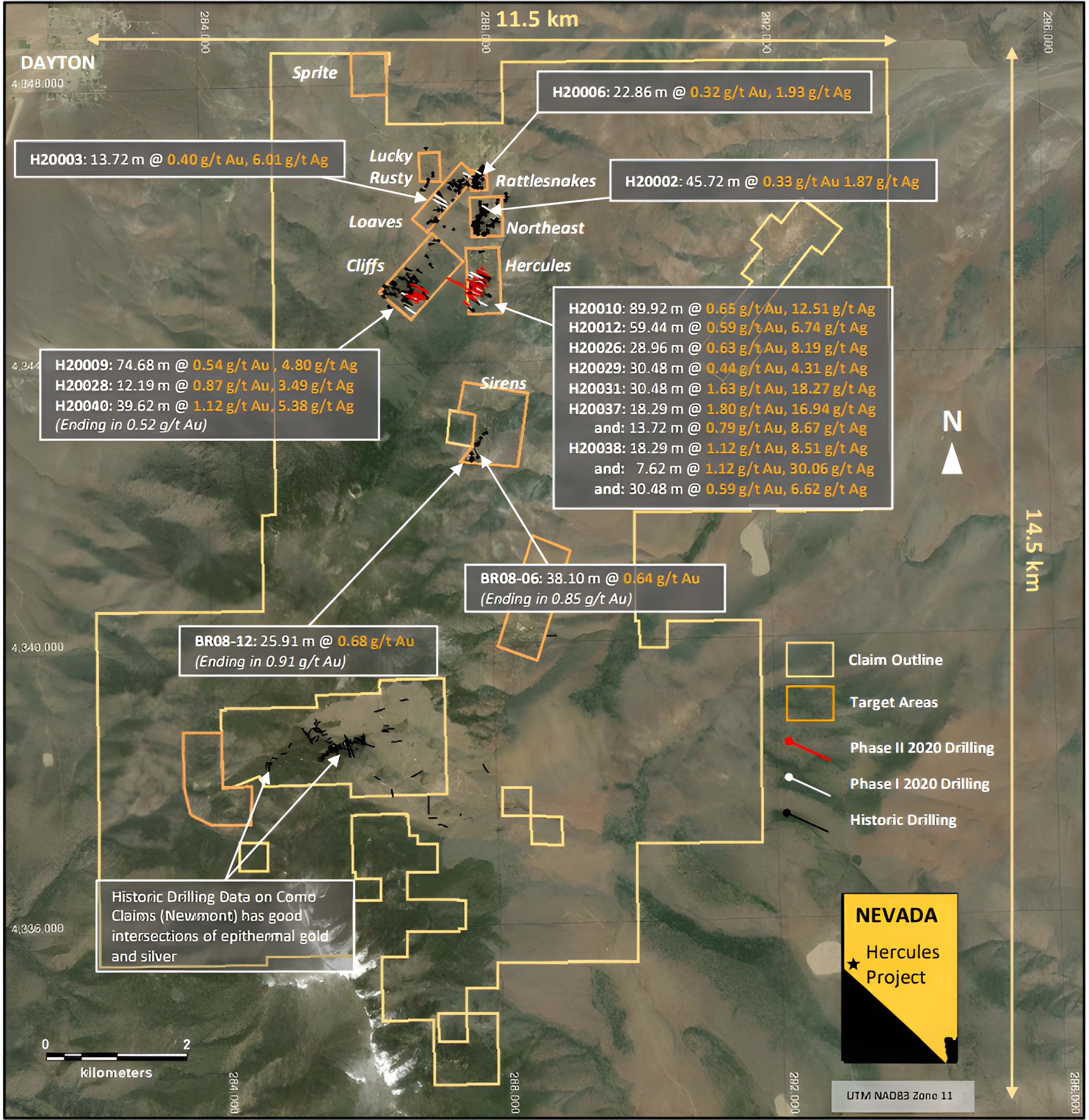
(Length is sample length; true thickness was estimated to be between 60% and 90% of sample length – per prior operator news releases)
Recent Exploration Activity
Work conducted by Eclipse from 2020 to early 2021, included mapping, geophysical surveys, chip sampling, and a reverse circulatory (“RC”) drill program throughout the project.
In March 2020, a rock chip sampling program over a strike length of approximately 260 meters were reported, indicating the presence of a potential high-grade core to the Hercules target, highlighted by rock sample 483737 containing 66.0 g/t Au and 333.0 g/t Ag and sample 483736 assaying 29.5 g/t Au and 880 g/t Ag. Additional sampling on the Hercules Target identified a broad zone of gold mineralization in which gold values are associated with widespread silicification.
On June 10, 2020, Eclipse reported on an its initial phase of drilling at Hercules, totaling 3,271 meters over 12 RC drill holes, with all targets containing gold mineralization and 11 of these drill holes intersecting significant oxidized gold mineralization. The results of this initial program were highlighted by hole H20009 assaying 0.54 g/t Au and 4.78 g/t Ag over 74.68 meters; hole H20010 assaying 0.65 g/t Au and 12.51 a/t Ag over 89.92 meters; and hole H20012 assaying 0.59 g/t Au and 6.74 g/t Ag over 59.44 meters. These initial encouraging results identified a shallow oxide-gold system with broad zones of higher-grade mineralization that appeared to strengthen towards the south. The initial drilling campaign by Eclipse identified several open-ended targets which suggested Hercules was open for expansion both along strike and at depth.
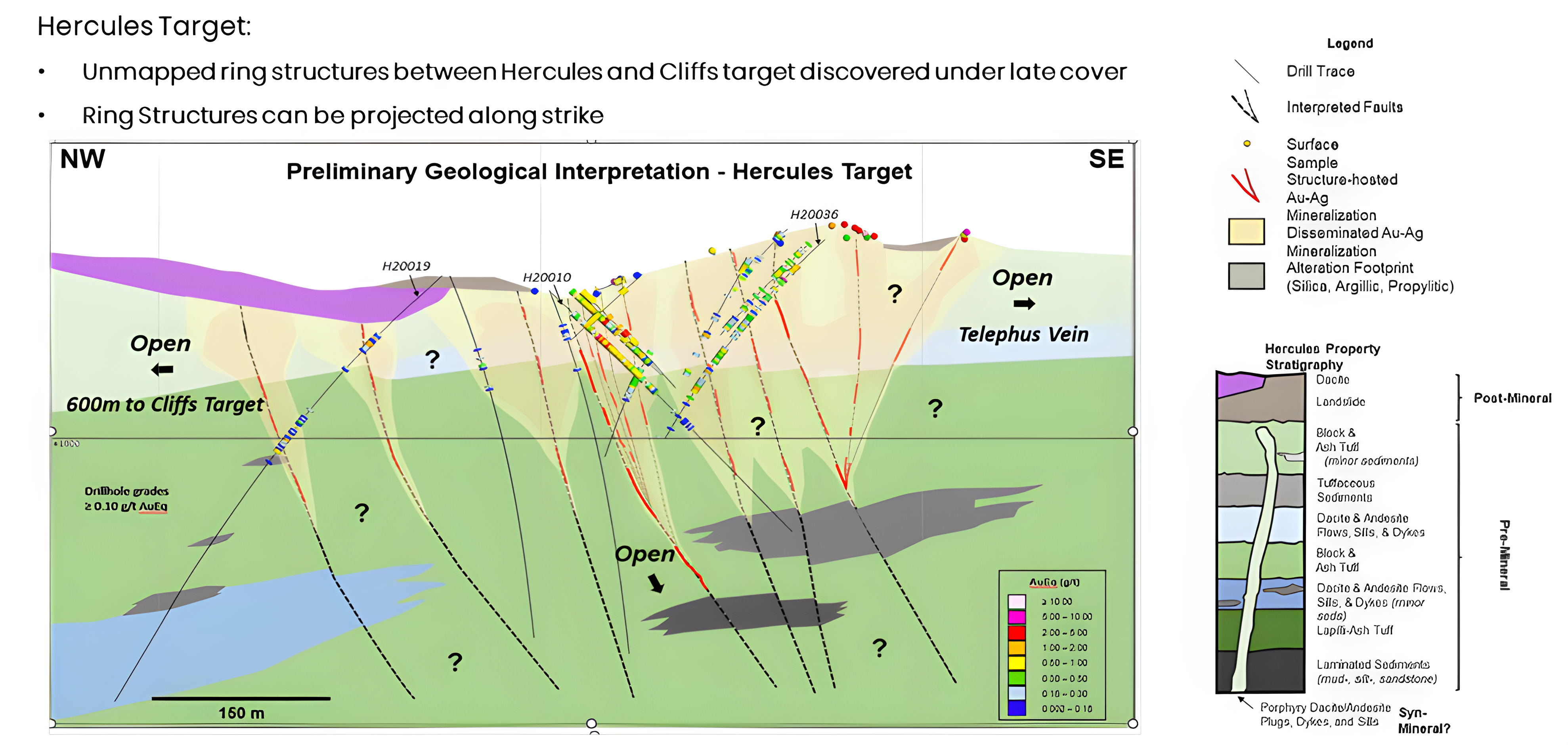
Eclipse announced the results of an induced polarization (“IP”) survey performed in July 2020, which demonstrated a good correlation between zones of silicification in outcrop and drilling and resistive features. The interpretation indicated the presence of two parallel and continuous NNE-trending, steeply west-dipping structures named the Hercules Structural Zone (approximately two-kilometers in length). This zone passes through and to the west of the main Hercules Target and may represent a feeder structure for mineralization. In addition, a large resistive feature at the southern end of the survey suggested a connection at depth between the Cliffs and Hercules Targets. This feature appears to be both open to and increasing in thickness to the south. The distance between the Cliffs Target and the Hercules Target is approximately 600 meters.
A second phase of drilling at Hercules Gold Project in the second half of 2020 focused on the Cliffs and Hercules Targets, testing a new geological model. This second phase consisted of 7,320 meters of RC drilling over 28 holes.
Hercules Target
Phase 2 drilling appeared to confirm the presence of a high-grade, near surface core of mineralization at the Hercules Target, as well as the new geological model. Results also suggest additional discoveries may be made in the largely untested overburden-covered area between Hercules and Cliffs. Phase 2 drilling at the Hercules target was highlighted by 30.48 meters of 1.63 g/t Au and 18.27 g/t Ag (H20031).
Of interest, the second phase of drilling also included one hole (H20019) drilled between the Hercules and Cliffs Target identified by the previous geophysical work. The hole identified two zones of low-grade mineralization (including 18.29 meters of 0.33 g/t Au and 8.45 g/t Ag) which suggested additional discoveries may be made in the largely untested overburden-covered area between Hercules and Cliffs
Cliff Targets
Phase 2 drilling at Cliffs successfully demonstrated that the proposed geological model was correct. Highlights from the phase 2 drilling included and 39.62 meters of 1.12 g/t Au and 5.38 g/t Ag (H20040).
In addition, the drilling revealed new gold mineralization further to the east that is untested by drilling. When combined with results at the Hercules showing, where additional gold bearing structures are being found to the west, the target corridor of mineralization on the project is now thought to be widening.
Both the Hercules and Cliffs Targets remained open along strike, across strike, and at depth, particularly east of the Hercules Target where additional high-grade surface samples remain untested by drilling.
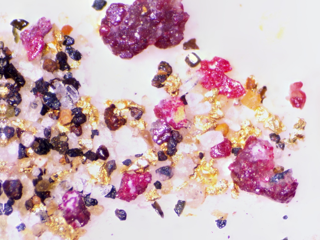
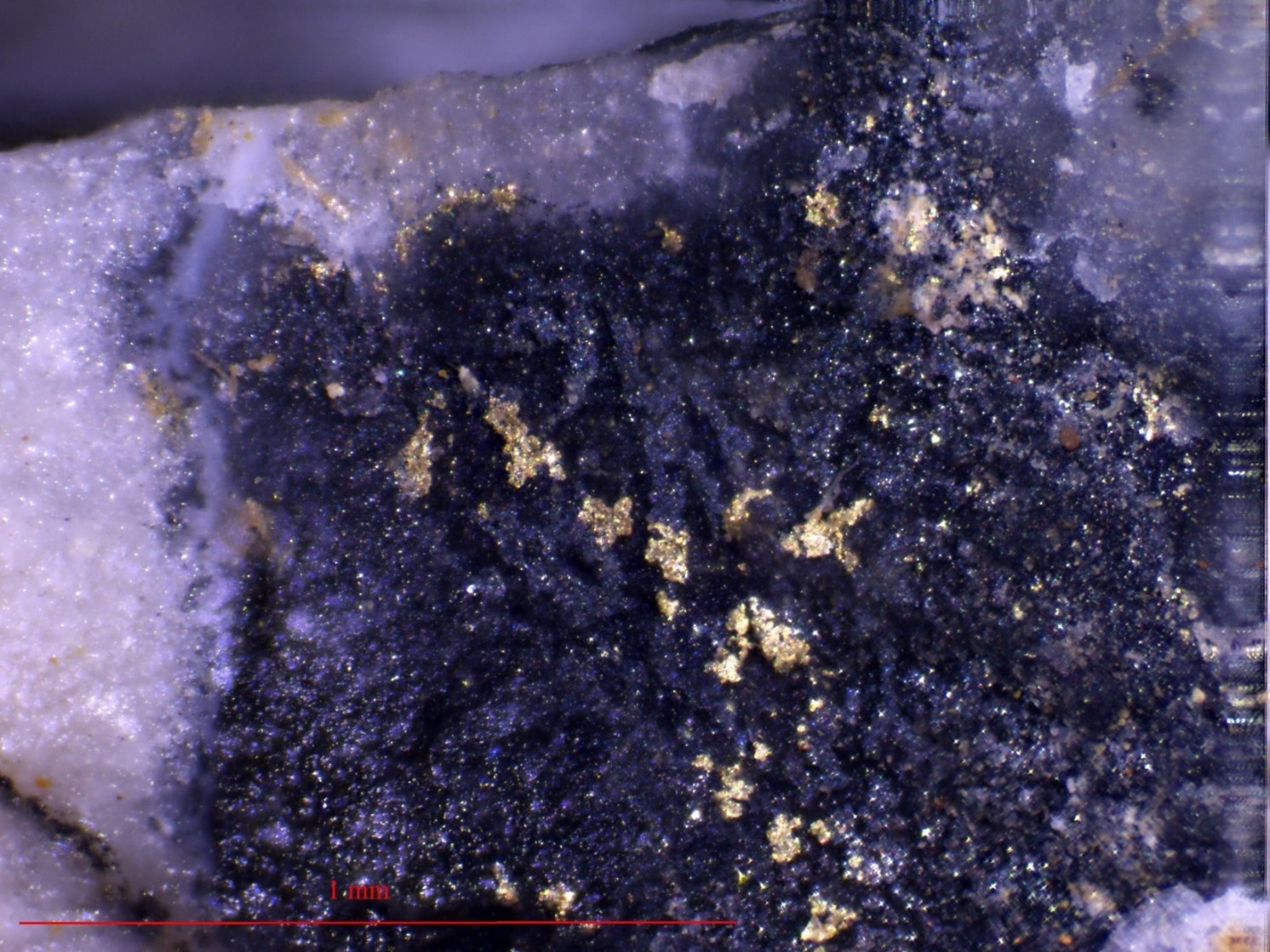
This includes the “Telephus Vein” where visible gold can also be collected at surface.

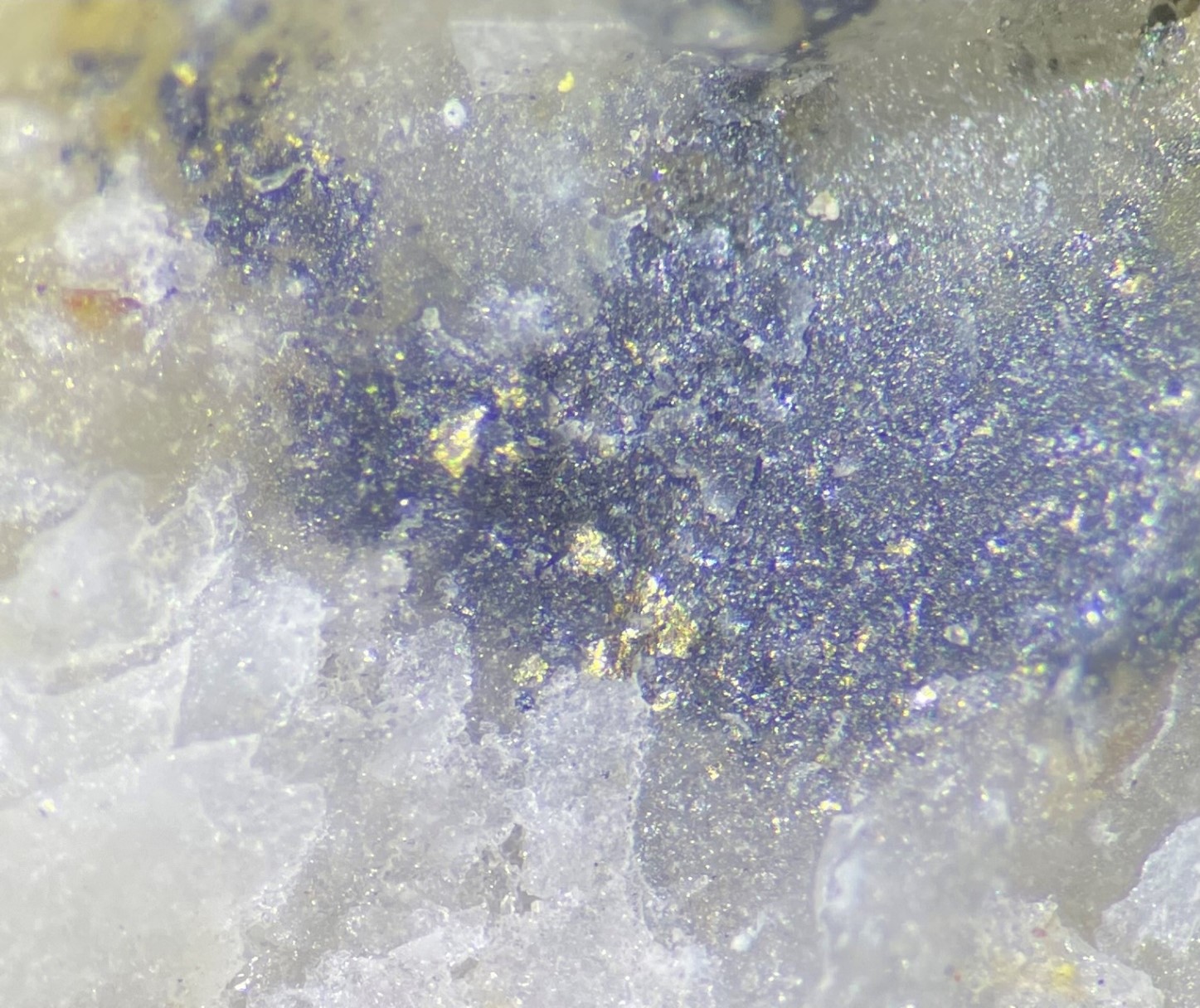
Following the acquisition of Eclipse, Elevation announced the results of a recently completed airborne geophysical survey in April 2021. The survey highlighted the structural framework at Hercules, providing support for the district-scale geological model. It also indicated the presence of an extensive and open-ended 13 kilometers long by 6 kilometers wide alteration zone trending northwest-southeast across the property that is coincident with known mineralization. Most importantly, the work identified at least 45 new targets for follow-up exploration and to be advanced.
Three targets were evaluated and two permitted for drilling.
At the permitted Sirens target historical intercepts of 38.10m grading 0.64 g/t Au (ending in 0.85 g/t Au) in hole BR08-06, and 25.91 m of 0.68 g/t Au (ending in 0.91 g/t Au) have been reported. Panned gold was collected at the Sirens showing.
At the Pony Meadows target gold was also panned near a historical working. Additional work is being completed prior to permitting at Pony Meadows.
A further site is permitted for exploration drilling, the Como Comets target is thought to be the extension of the past producing Como District held by Newmont Mining Corporation, through it’s subsidiary Fronteer Development USA. The Newmont ground is held entirely within the larger Hercules Gold Project.
Following the completion of the airborne geophysical survey in early 2021, further significant exploration work at Hercules was halted, by previous operators giving StrikePoint an opportunity to make meaningful advancements on the property.
The acquisition of Hercules in August 2024, at a minimal acquisition cost, gives StrikePoint a quality early-stage gold-silver exploration project in a Tier 1 jurisdiction with significant potential and drill ready targets across a large land package with many untested targets and known mineralization over a large area. StrikePoint is excited about the opportunity the Hercules Gold-Silver Project provides and continues to review all historical data available to guide future exploration work.